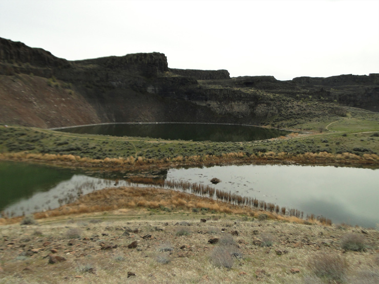
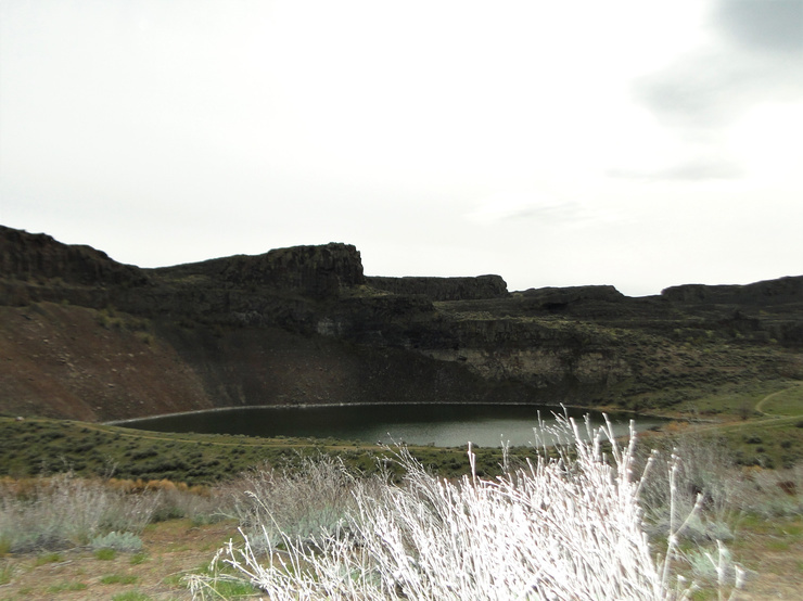
A first date at Ancient Lakes.
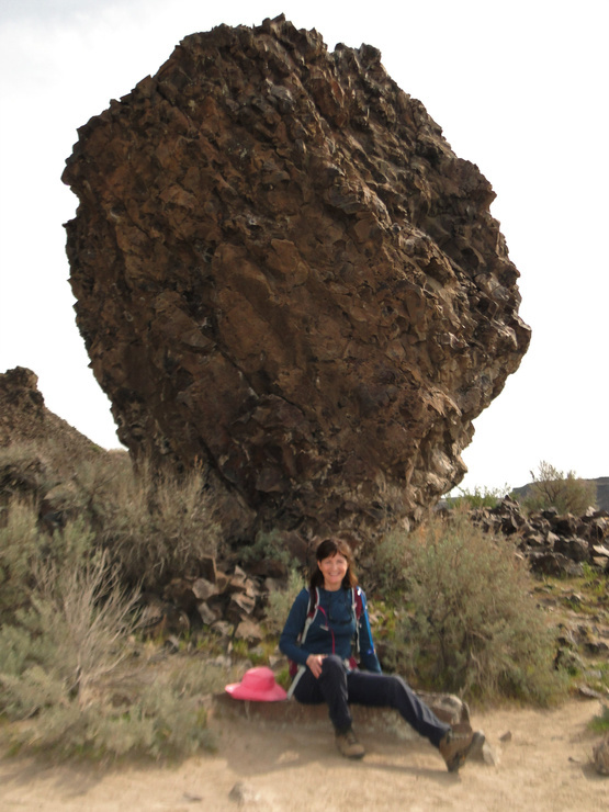
What a fun first date! Today I met a psychologist, Gregg, for a short hike to Ancient Lakes. We hiked five miles with about 500 feet of elevation gain.
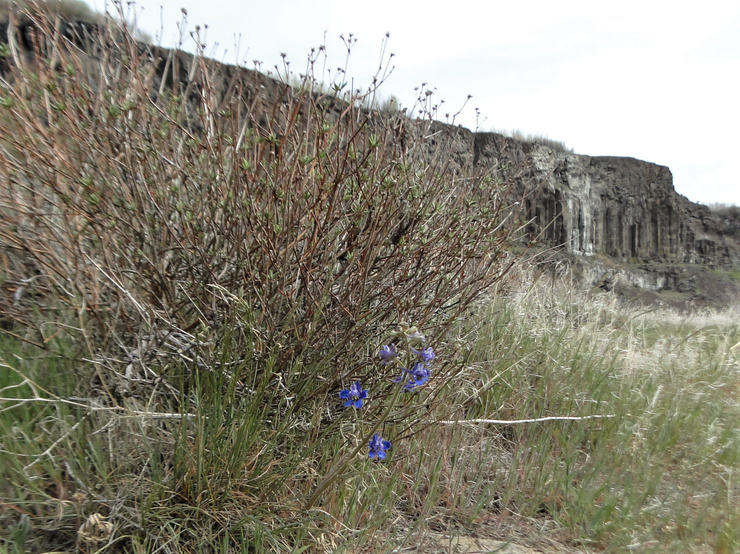
"Want some grapes?" I asked Gregg during lunch. "How about some teeth-cleaning celery?" He offered me dried figs. After lunch, Gregg stretched out for a short nap. I wandered around taking pictures.
Wondered if my enthusiasm, high energy and intensity overwhelmed him. "You are definitely a higher wattage bulb than I am but that's okay," he said.
Three years ago, Karen and I climbed to a saddle in the cliffs and then higher. Wonderful views! There's a big lake on the other side. Descending, I sat down to butt-slide in sliding rocks where I couldn't stand up. It mystifies me how Karen walks down. She must be part mountain goat.
Due to the pandemic, Ancient Lakes was mobbed by a hundred or more people. People are desperate to get outdoors. Horses, dogs, tents, families, runners, hikers, mountain bikers. But the place is so vast, it did not feel crowded.
The place was pristine. The annual Boy Scout cleanup crew must have just finished the job. Year after year, fishermen leave a disgusting mess at the lakes.
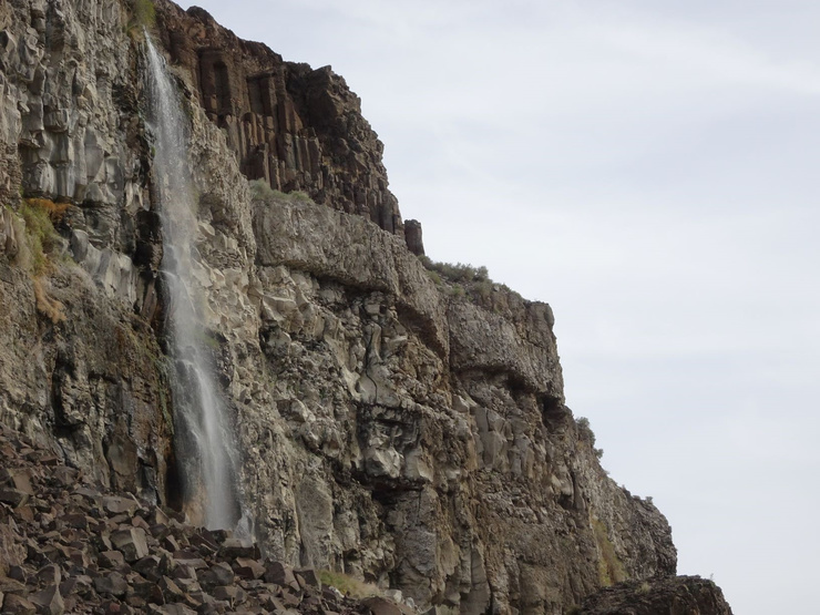
We saw three waterfalls. This is the best picture. One of the waterfalls looks like a vulva when I photograph it. Must have dirty mind.

 21
21


Enjoy being online again!
Welcome to the community of good people who base their values on evidence and appreciate civil discourse - the social network you will enjoy.Create your free account
9 comments
Feel free to reply to any comment by clicking the "Reply" button.
I looked up Ancient Lakes, to my surprise the elevation maxes out at about 1200 ft. From the pictures I thought it might be above the treeline. Is it kind of arid?
 alliwant
Level 7
Apr 4, 2021
1
alliwant
Level 7
Apr 4, 2021
1
Ancient Lakes lies on the western edge of the Columbia Basin near the town of Quincy in Washington State.
An arid shrub-steppe desert, the Columbia Basin was irrigated by dams. Now it's an agricultural area growing crops and wine grapes.
Hundreds of massive Missoula Floods in the Ice Age
The Missoula floods were cataclysmic glacial lake outburst floods that swept periodically across eastern Washington and down the Columbia River Gorge at the end of the last ice age. These events have been researched since the 1920s. These were the result of periodic sudden ruptures of the ice dam on the Clark Fork River that created Glacial Lake Missoula.
After each ice dam rupture, the waters of the lake would rush down the Clark Fork and the Columbia River, flooding much of eastern Washington.
The water was over a mile high. It lifted Eastern Washington topsoil and deposited it in the Willamette Valley in Oregon, now the richest soil growing area in the world.
The Missoula floods carved out lakes, rolling, crenulated hills, cliffs and more. "Scablands" is a name used to describe Eastern Washington.
Watch "Nick on the Rocks," a PhD. geology professor at Central WA University. He has fun, fascinating five minutes videos.


It looks like a wonderful place to be ate alive by mosquitoes.
Thanks for the photos so I don't have to go. 
 Willow_Wisp
Level 8
Apr 4, 2021
1
Willow_Wisp
Level 8
Apr 4, 2021
1
There was enough wind. No mosquitoes. I brought mosquito repellent.
I led Greg up on a hillside above the lakes for a better view.
Nice first date, I hope he can keep up with you.
 HippieChick58
Level 9
Apr 3, 2021
1
HippieChick58
Level 9
Apr 3, 2021
1
We'll see.
And what happened next?
 Jolanta
Level 9
Apr 3, 2021
Jolanta
Level 9
Apr 3, 2021
 1
1
Jolanta
We had fun.
@LiterateHiker I am happy you did. No wonder you think it was a great first date.

Enjoy being online again!
Welcome to the community of good people who base their values on evidence and appreciate civil discourse - the social network you will enjoy.Create your free account
Share this post
Related Groups More
Dog Lovers
1389 members
Categories
Agnostic does not evaluate or guarantee the accuracy of any content. Read full disclaimer.