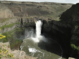
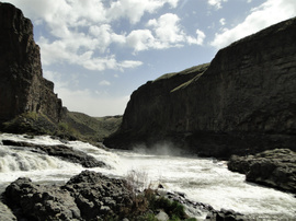
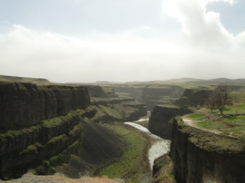
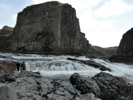
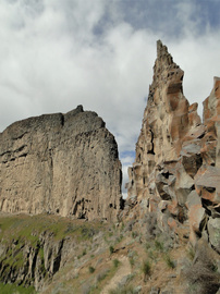
Majestic hike a year ago today. Palouse Falls State Park, WA.
For our second date, Gregg took me to Palouse Falls. We scrambled on steep trails, rock slides and boulders. I felt appalled by graffiti on some rock cliffs and spires. We had fun.
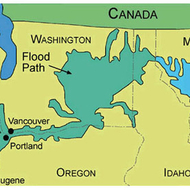
About fifteen-thousand-years ago, massive Ice Age floods scoured out the Eastern Washington landscape and formed the cliffs of modern-day Palouse Falls.
Palouse Falls drops almost 200-feet on its way to the Palouse River, which feeds into the Snake River of southeastern Washington. The falls are massive, carrying an estimated volume of 2,000-cubic-feet of water over the underlying lava flow cliffs every second.
Palouse Falls is the last remaining year-round waterfall that once stood in the path of the ice age floods.
The play of light on the canyon and surrounding landscape changes throughout the day as light first hits the falls then fades away into the evening.
Imagine a wall of water 40-feet high barreling toward you.
The Missoula Floods were a series of floods that occurred in the Pacific Northwest at the end of last Ice Age. They were a cataclysmic type of flood called a glacial lake outburst flood. They were unimaginably large. During peak discharge they had a flow of thirteen-
million meters per second. Overall, there were roughly 40-floods an average of 50-years apart.


Enjoy being online again!
Welcome to the community of good people who base their values on evidence and appreciate civil discourse - the social network you will enjoy.Create your free account
4 comments
Feel free to reply to any comment by clicking the "Reply" button.Thank you for this. I learned something new. Dry Falls is known for this same series of events and I wasn't aware there were multiple places. I found a video of Palouse Falls
. I have also posted a video of Dry Falls from Nick on the Rocks.
I think people would appreciate a video of the actual falls. I don't think people appreciate the geological diversity of this state.
The Great Missoula Floods lifted topsoil in Eastern Washington and deposited it in the Willamette Valley, Oregon, now considered one of the most fertile growing areas of the world.
@LiterateHiker And we want it BACK!!! 
@LiterateHiker Those are really great depictions of this event (or should I say these events because they happened many times). One thing I was looking for was, as you said, the fact that a lot of top soil from the higher states were carried down to Oregon making the Willamette valley one of the most fertile areas in the NW. I am also assuming, Montana, Idaho and that part of Washington must be on higher ground then the parts that were flooded. This was the first time I have seen it pictorially.
Enjoy being online again!
Welcome to the community of good people who base their values on evidence and appreciate civil discourse - the social network you will enjoy.Create your free account
Share this post
Categories
Agnostic does not evaluate or guarantee the accuracy of any content. Read full disclaimer.
